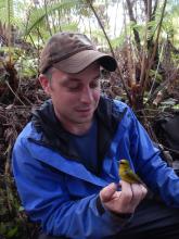
Drew Derderian
Chief Consultant

A picture of Drew Derderian wearing nice clothes and a tie.

Drew Derderian, the chief consultant of TwinVert, is a geographic information system specialist with more than ten years of experience in mapping, programming, marketing, and design. As the chief consultant, Drew is responsible for developing and implementing service, resource and team management, and communicating effectively to meet the needs of TwinVert's clients.

Drew’s studies and experience span multiple facets of natural resources. He earned an M.S. in Forestry at Colorado State University in 2015, specializing in research on fire ecology and forest biomass. During his studies, he also worked with the Center for Environmental Management of Military Lands (CEMML) both individually and as part of a team to analyze the wildland fire risk of nearly every Army and Air Force base in the United States.

Prior to earning his M.S., Drew’s experience in maps was primarily focused on incident response and planning. Drew received his undergraduate in Fire and Safety Engineering: Administration at Eastern Kentucky University, where he developed programming skills and utilized mapping to analyze mitigation, preparedness, response, and recovery.

Outside of business hours, Drew serves on the Natural Resources Advisory Board in Fort Collins, and volunteers his professional skills for other nonprofits in the community.


Logan Derderian
Director of Field Operations
Geospatial Specialist

Logan Derderian, holding a bird in the forest.

Logan Derderian is Director of Field Operations and a Geospatial Analyst at TwinVert. Since graduating with a BS in Natural Resource Management and Conservation, he has conducted ecological research throughout the USA and internationally as a biologist working for universities, environmental nonprofit organizations, environmental consulting firms, and the U.S. Geological Survey (USGS). A fascination with spatial ecology led to pursuit of a MS in Environmental Science with a graduate certificate in Geographic Information Science from the University of Colorado.

Logan joined Twinvert in 2018 as a project manager leading a study of the threatened New Mexico meadow jumping mouse in southwest Colorado. Since that time, he has held a variety of technical and leadership positions, working both in a field capacity and as a GIS specialist. 


Alyssa Stephens
Director of Communications

Beautiful Alyssa Stephens in a red dress with sunglasses.

Alyssa Stephens is the Director of Community Outreach and Engagement at TwinVert, LLC.  With a decade of experience in communication, education, and program management, Alyssa brings an emphasis on transparency and co-creation to every project.      

Alyssa received her Master’s degree in Sociology from Colorado State University, specializing in environmental sustainability and community development.  She is also a Certified Interpretive Guide and received advanced certification from the International Association for Public Participation (IAP2). 

Alyssa has designed, managed, and evaluated educational programs at universities, nonprofit organizations, and local governments.  Prior to joining TwinVert, she spent time designing educational materials to prevent stormwater pollution, managing sustainability training programs for K-12 teachers, and evaluating programs designed to increase retention of women in STEM.  She has a strong track record of managing large, complex projects that span the public and private sector, and more than five years of facilitation experience with teams large and small.


Michael Menand
Project Manager
Geospatial Specialist

Michael Menand, looking quite professional.

Michael Menand is a Project Manager at TwinVert, bringing his experience in geographic information systems and program management to our design and consulting services.

Michael’s background includes a unique mix of public, private, and research work. Prior to joining TwinVert, Mike collaborated with Drew on several wildland fire risk analyses at the Center for Environmental Management of Military Lands (CEMML). He was also a Regional GIS Coordinator at Level 3 Communications, where he was responsible for managing, analyzing, reporting, and mapping the company's GIS data. His public sector experience comes from his time at the City of Longmont supporting the Fire, Utilities, Parks, and Planning departments.

Michael completed his B.S. in Geography at the University of Colorado in 2006, where during his studies, he assisted researchers at the National Renewable Energy Laboratory (NREL) with spatial analysis on domestic and international renewable energy projects.

In his free time, Michael enjoys outdoor adventures mountain biking, snowboarding, and hiking with his family.